

Introduction
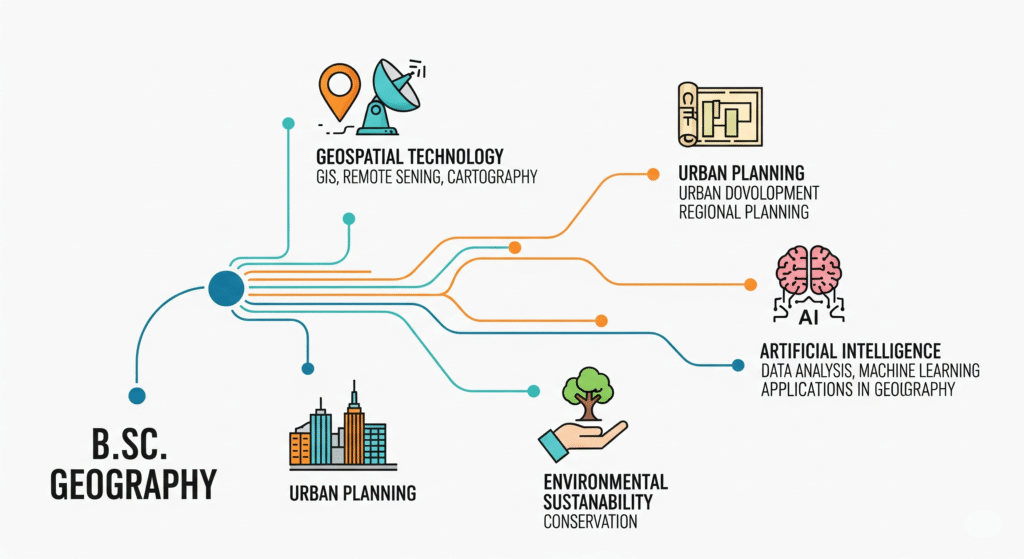
Graduates with a BSc Geography background can leverage their skills across ten high-growth domains, from Geospatial Software Development to Archaeology. These career pathways combine specialized postgraduate programs, professional certifications, and practical training. By aligning educational credentials with internships and certifications, graduates can position themselves for leadership roles in India’s spatial and socio-environmental sectors. India’s geospatial analytics market reached USD 5.2 billion in 2024 and is projected to grow to USD 18.8 billion by 2033, with a 14.35% CAGR. This expansion, along with a boom in spatial data, has created robust opportunities in geoinformatics, with 879 GIS job listings on LinkedIn. Traditional roles also remain vital, with steady demand for land surveyors and cartographers.
Market Overview
- Industry Value: India’s geospatial analytics market was valued at USD 5.2 Billion in 2024 and is projected to reach USD 18.8 Billion by 2033 (CAGR 14.35%) IMARC Group.
- Growth Drivers: Adoption spans urban planning, agriculture, disaster management, and transport, fueling demand for spatial professionals.
Did you know?
Telangana’s Bhu Bharati Act 2024 mandates GPS-based land sketches for agricultural registrations—and plans to recruit 5,000 licensed surveyors by August 2025 to implement it, The Times of India.
Traditional Geography Careers


1. Land Surveyor
- Scope of Work:
- Boundary demarcation and topographic surveys using GPS & total stations.
- Stakeout and as-built mapping for infrastructure projects.
- Demand & Training:
- 5,000 surveyors to be trained under Telangana’s Bhu Bharati Act The Times of India.
- Survey of India offers Basic and Advanced Surveying courses at its training institutes Survey of India.
- Pathway:
- 12th Science (Maths)
- BSc Geography
- Diploma/Certification at a Survey Training Institute (STI)
- Field internships with state PWD or Survey of India
2. Cartographer & GIS Technician
- Scope of Work:
- Creation of thematic, topographic, and interactive maps.
- Geodatabase maintenance and basic spatial analyses in ArcGIS/QGIS.
- Demand & Training:
- Niche roles in government agencies (Survey of India, State Survey Institutes).
- QGIS certifications and short courses.
- Pathway:
3. Geoinformatics & GIS Careers
GIS Analyst / Developer
- Scope of Work:
- Build web-mapping applications and spatial databases.
- Automate geoprocessing workflows using Python, SQL, and APIs.
- Top Employers:
- Esri India: Market leader; hiring across development, consulting, and support esri.in.
- MapmyIndia: Location-tech pioneer; roles in GIS engineering and data science MapmyIndia.
- NRSC (ISRO): Scientist/Engineer and Technician-B positions for remote sensing nrsc.gov.in.
- Pathway:
- BSc Geography or B.Tech/M.Sc. Geoinformatics
- GIS certifications (e.g., ESRI Technical Certification)
- Internships or projects with leading GIS firms

Remote Sensing Specialist
- Scope of Work:
- Pre-processing and analysis of satellite/aerial imagery for land-use, agriculture, and disaster response.
- Integrate multispectral and radar datasets for environmental monitoring.
- Training & Demand:
- M.Sc. in Geo-information Science & Earth Observation (IIRS–UT-ITC) courses.
- Strong hiring at NRSC, ISRO, and private consultancies.
- Pathway:
- BSc Geography/Geology with Remote Sensing electives
- Postgraduate diploma or M.Sc. in Remote Sensing & GIS
- Field projects and internships at space and mapping agencies
Top GIS Employers
| Employer | Roles | Location | Source |
| Esri India | GIS Analyst, Developer, Consultant | Bengaluru, Pune | esri.in |
| MapmyIndia | GIS Engineer, Data Scientist | New Delhi, Bengaluru | MapmyIndia |
| NRSC (ISRO) | Scientist Engineer ‘SC’, Technician-B | Dehradun, Hyderabad | nrsc.gov.in |
| Survey of India (STI) | Surveyor, Cartographer, GIS-GPS Technician | Uppal (Hyderabad) | Survey of India |
| QGIS Training (TGIS) | GIS Operator, Technician | Online / Nationwide | tgis.co.in |
4. Hydrogeology & Water-Resource Engineering
Hydrogeologist
Hydrogeologists investigate groundwater distribution and movement within aquifers, applying principles of Darcy’s law to model subsurface flow. They characterize key aquifer properties—transmissivity and storativity—design monitoring networks, and advise on well siting and sustainable pumping rates. As of July 2025, Naukri.com lists 221 Hydrogeology job vacancies across India. Entry typically requires a B.Sc. in Geology or Earth Sciences, as well as a BSc in Geography, followed by an M.Sc. in Hydrogeology or Applied Geology. Hands-on experience through field internships and training in groundwater-modeling tools such as MODFLOW is highly valued by employers.
Water-Resource Engineer
Water-Resource Engineers integrate hydrologic analysis with civil-engineering design to plan and implement irrigation systems, urban water-supply networks, stormwater management schemes, and flood-control structures. They develop hydraulic and hydrologic models, oversee the design and construction of canals, retention basins, and pipelines, and ensure compliance with water-allocation regulations and sustainability targets. Naukri.com currently advertises 6,252 Water Resource Engineer positions nationwide, reflecting robust hiring by infrastructure consultancies, government departments, and international contractors. Candidates generally hold a B.Tech in Civil or Environmental Engineering and an M.Tech in Water Resources or Hydrology, supplemented by project internships under agencies such as the Central Water Commission.
5. Environmental & Sustainability Careers
Environmental Consultant
Environmental Consultants conduct Environmental Impact Assessments (EIAs), perform risk analyses, and design mitigation measures for projects spanning mining, construction, and manufacturing. They manage baseline data collection, prepare regulatory submissions under MoEF&CC guidelines, and facilitate stakeholder consultations during public hearings. Glassdoor India lists 640 Environmental Consultant openings, indicating sustained demand in private consultancies and government bodies. A B.Sc. or M.Sc. in Environmental Science or Engineering,BSc Geography, coupled with MoEF&CC-approved EIA certification and field-level internship experience, forms the standard qualification profile on Glassdoor.
Sustainability / ESG Analyst
Sustainability Analysts collect, analyze, and report on environmental, social, and governance (ESG) metrics to guide corporations in reducing carbon footprints, improving resource efficiency, and complying with global frameworks such as GRI and TCFD. They develop sustainability reports, conduct life-cycle assessments, and advise on CSR initiatives to enhance corporate reputation and stakeholder trust. Glassdoor reports 727 Sustainability Analyst positions in India, illustrating growing corporate investment in ESG performance. Professionals typically hold an MBA or M.Sc. in Sustainability/ESG, supplemented by specialized certifications like CFA’s ESG Certificate or GRI accreditation.
6. Urban Planning & Infrastructure
Urban Planners devise land-use plans, zoning regulations, and community-development strategies—balancing housing, transport, and environmental considerations to foster sustainable urban growth. They perform demographic and socio-economic analyses, conduct public consultations, and prepare master plans for municipal bodies and private developers. Naukri.com lists 2,522 Urban Planner vacancies across India, underscoring strong recruitment by municipal authorities and planning consultancies. Entry paths include a B.Plan or M.Plan from accredited institutions, with optional UPSC Town Planner exam qualification for government roles and internships at Urban Local Bodies (ULBs).
Transport Planner / Smart-City Analyst
Transport Planners model transit networks and optimize traffic flows using software such as VISSIM and VISUM, while Smart-City Analysts integrate IoT and GIS platforms to monitor urban infrastructure and enhance service delivery under initiatives like India’s Smart Cities Mission Naukri. They design public-transport routes, manage real-time mobility dashboards, and support policy frameworks for sustainable urban mobility. Naukri.com currently advertises 4,239 Transport Planner roles nationwide, reflecting rising demand for experts who can shape resilient and efficient transport systems. Qualifications often include an M.Plan or postgraduate diploma in Transport Planning, along with hands-on project attachments under the Ministry of Housing and Urban Affairs (MoHUA) Naukri.
7. Specialized & Interdisciplinary Career Pathways after BSc Geography

7.1 Geospatial Software Development & Earth Science
- Geospatial Software Developer
- Education: M.Sc. in Geo-information Science & Earth Observation (IIRS–UT-ITC joint programme).
- Certification: GISP® (Certified GIS Professional) requiring ≥4 years’ experience, portfolio review and core‐technical exam.
- Earth Science Specialist
- Education: M.Sc. in Applied Geoinformatics and Environment Management.
- Career Roles: Geological surveyor, mineral exploration analyst, EIA specialist.
7.2 Geotourism & Heritage Management
- Geotourism Professional
- Education: Master of Tourism & Travel Management (MTTM) at IGNOU and others, focusing on sustainable destination planning and eco-tourism.
- Skills: Interpretive programming, visitor-experience design, community engagement.
- Heritage Manager
- Education: MMS in Heritage Management with a blend of conservation, business, and sustainable-tourism strategies.
- Roles: Museum curator, heritage‐site manager, policy advisor for cultural preservation.
7.3 Rural Development, Social Work & Sociology
- Rural Development Manager
- Education: PGDM in Rural Management at IRMA Anand IRMA.
- Roles: Project lead for livelihood programmes, cooperative development specialist.
- Social Worker & Sociologist
- Education:
- MSW at IGNOU with block placements in community development.
- MA Sociology at IGNOU for advanced social-research methods.
- Career Paths: NGO programme coordinator, social-impact analyst, policy research associate.
- Education:
7.4 Disaster Management & Climate Science
- Disaster Management Expert
- Education: PG Diploma in Disaster Management (IGNOU/NIDM) or tailored NIDM programs under NDMA guidelines.
- Roles: Emergency‐response planner, risk-assessment specialist, community resilience trainer.
- Climate Scientist
- Education: M.Sc. in Climate Change & Sustainability.
- Roles: Climate-model analyst, adaptation-strategy consultant, sustainability researcher.
7.5 Public Policy & Geopolitics
- Public Policy Analyst
- Education: Master’s in Public Policy (MPP) at NLSIU Bangalore National Law School of India University.
- Roles: Policy-drafting specialist, programme evaluator, stakeholder engagement lead.
- Geopolitical Risk Analyst
- Pathway: Diplomas in International Relations combined with GIS and big-data courses; internships at think-tanks (IDSA, ORF).
- Roles: Corporate risk consultant, defence-strategy advisor, global-affairs researcher.
7.6 Archaeology
- Archaeologist
- Education: M.A. in Archaeology or PG Diploma (e.g., Pondicherry University’s Rock Art & Agamic Studies).
- Roles: Excavation supervisor, heritage-impact assessor, museum collection manager.
7.7 Demography & Population Studies
- Demographer
- Education: M.A./M.Sc. in Population Studies or Bio-Statistics & Demography at IIPS Mumbai.
- Roles: Population projections analyst, survey-research specialist, public-health demographer.
8. Education & Certification Roadmaps after BSc Geography
- GIS Professional Certification (GISP®)
- UGC NET (Geography, Sociology, Population Studies)
- Conducted by NTA; ≥55% in M.Sc./M.A.; qualification required for Assistant Professor/JRF posts (UGC NET official site).
- EIA Consultant Accreditation (NABET/QCI)
- Mandatory for Environmental Impact Assessment consultants; covers quality management, expert panels, and application process Environment Clearancenabet.qci.org.in.
- Disaster-Management Courses (NIDM/IGNOU)
- Certificate to PG-level programmes in Disaster Risk Reduction & Management under NDMA norms iuin-drr.nidm.gov.inNPTEL Online Courses.
- Specialized Postgraduate Degrees:
- IIRS M.Sc. in Geo-information Science & EO iirs.gov.in
- GGSIPU M.Sc. in Applied Geoinformatics & Environment Management The Times of India
- Azim Premji University M.Sc. in Climate Change & Sustainability Azim Premji University
- Ahmedabad University MMS in Heritage Management Ahmedabad University
- IGNOU MSW, PGDM-RM (IRMA), M.A. Sociology, PG Diploma in Disaster Management IGNOUIRMA
9. Actionable Next Steps
- Identify Your Niche: Select the domain that aligns with your passion—technical, socio-environmental, or policy-driven.
- Enroll in Targeted Programmes: Apply for relevant postgraduate degrees or diplomas (e.g., IIRS Geo-information, IRMA PGDM-RM, IGNOU MSW).
- Secure Professional Certifications: Register for GISP, UGC NET, EIA accreditation (QCI/NABET), and NIDM courses.
- Obtain Practical Experience: Pursue internships with ISRO/IIRS, NDMA state cells, environmental consultancies, heritage bodies (ASI/INTACH), and policy think-tanks.
- Build a Portfolio: Document GIS applications, EIA reports, excavation logs, policy briefs, or community-development case studies.
- Network & Professional Engagement: Join professional bodies (GISCI, IGS, NIDM alumni), attend workshops, and contribute to open-source or academic publications.
Concusion
In conclusion, the B.Sc. in Geography serves as a powerful foundation for a wide array of high-growth and impactful careers. The notion of geography being a traditional, map-focused discipline is outdated; today, it is a gateway to leadership roles in India’s rapidly expanding spatial and socio‐environmental sectors. The country’s geospatial analytics market, valued at USD 5.2 billion in 2024, is projected to grow to an impressive USD 18.8 billion by 2033, with a CAGR of 14.35 percent. This robust market growth underscores the immense potential for skilled graduates.
To capitalize on these opportunities, a strategic approach is essential. Your B.Sc. is the starting point, but it must be supplemented with targeted postgraduate education, professional certifications, and hands-on experience. Pursuing specialized degrees like an M.Sc. in Geo-information Science at IIRS or an M.Sc. in Climate Change at Azim Premji University can provide the deep expertise needed for specialized roles. Similarly, certifications such as GISP for geospatial professionals or MoEF&CC-approved EIA accreditation for environmental consultants are crucial for professional credibility and advancement.
Furthermore, practical training through internships and field placements is non-negotiable. Whether it’s interning with ISRO, working with environmental consultancies, or gaining experience at planning agencies, these experiences are vital for building a strong portfolio and positioning yourself for success. By aligning your educational credentials with these practical milestones, you can forge a rewarding career path in fields like geoinformatics, urban planning, disaster management, or environmental sustainability. The future for a B.Sc. A geography graduate is not just about understanding the world—it’s about actively shaping it.